Defining resilient places
Resilience is embedded in the founding ethos of AlphaGeo. From day one, we were motivated to define this ever more widely used term as it pertains to geographies and societies. What does it mean for a place or community to be resilient? How do we measure it?
A working definition of societal resilience is:
| The capacity of the people, institutions and economy of a place to absorb shocks, fund recovery, and maintain performance. |
AlphaGeo measures resilience in two of our core products:
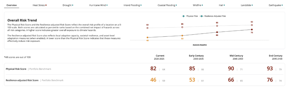
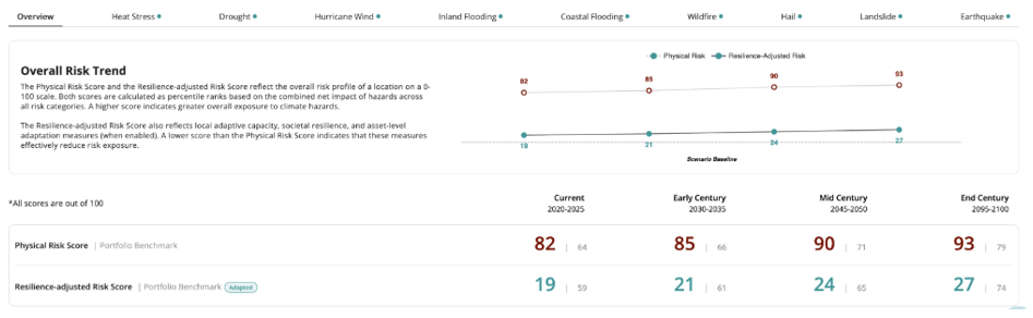
- Resilience-adjusted Risk captures the adaptation capacity of a location to offset climate hazards, subtracting the adaptation capacity score from the hazard score to generate a formal numerical value that can be benchmarked and modified through remediation measures, and
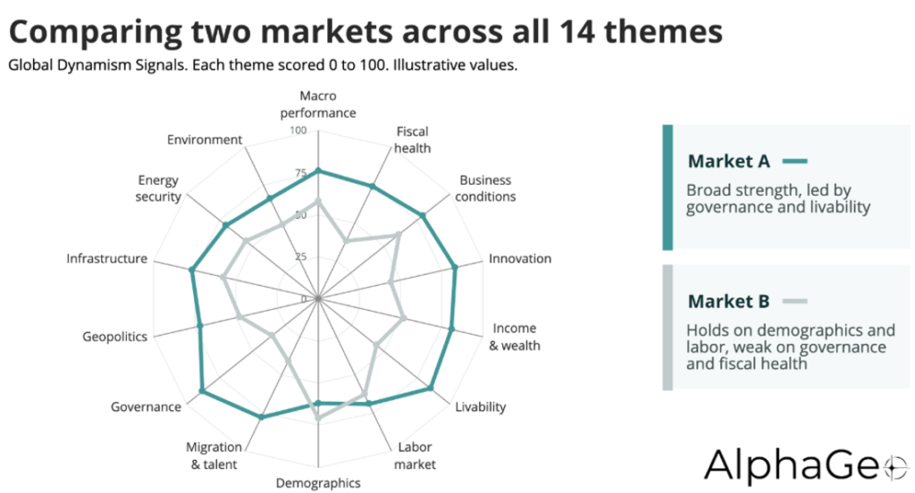
- Global Dynamism Signals captures more than one hundred distinct variables across nearly twenty categories that support location resilience at various geographic resolution, also allowing for benchmarking and guiding investment.
A ground-truth risk model
AlphaGeo’s Climate Risk and Resilience Index (CRRI) moves from hypothetical risk modeling to real-world resilience scoring through our triple-layer adaptation workflow:
| Layer | What it captures |
|---|---|
| 1. Local adaptation capacity | Hazard-specific defenses in the vicinity such as flood barriers, drainage systems, water storage, fire response, building strength ratings, electricity grid reliability, and more. |
| 2. Societal resilience | Fiscal and socioeconomic indicators such as income level, human development, and demographic vulnerability. |
| 3. Asset remediation checklist | An extensive checklist of site-specific mitigation measures with self-reported answers. |
Each of the three layers individually – and in aggregate – lead to a calculated reduction in the location’s risk profile, resulting in the Resilience-adjusted Risk score.
The link between resilience and performance
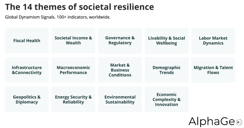
Global Dynamism Signals captures the resilience of a location across a much wider set of themes beyond climate. It is a macro intelligence dashboard that consolidates more than one hundred indicators across macroeconomic, fiscal, socioeconomic, geopolitical and environmental domains. These features are captured from an array of credible sources, frequently updated, and available at various resolutions from the national to the local.
Evaluating a market requires taking this holistic view of this diverse set of factors in a manner that is standardized across the world with built-in rankings and time-series trends for comparison.
AlphaGeo’s clients use both the Climate Risk and Resilience Index (CRRI) and Global Dynamism Signals (GDS) as a robust toolkit for:
- Market research and investment strategy: Identifying emerging trends and anticipating market dynamics to guide asset allocation.
- Advisory and consulting: On-demand cross-market indicators for timely delivery of research.
- Policy analysis: Benchmarking performance across metrics to inform strategic planning and public policy.
| Climate Risk and Resilience Index | Global Dynamism Signals | |
|---|---|---|
| Question answered | Can this location withstand a shock? | How does this market perform? |
| Coverage | Any location worldwide at granular resolution | Countries, provinces, cities |
| Breadth | 10 hazards, 4 time periods, 3 climate scenarios | 100+ indicators across 14 themes |
| Societal element | Layer 2 of the triple-layer offset | The full thematic set |
| Delivery | Platform, API, Snowflake, direct data | Dashboard plus Global Data Marketplace |