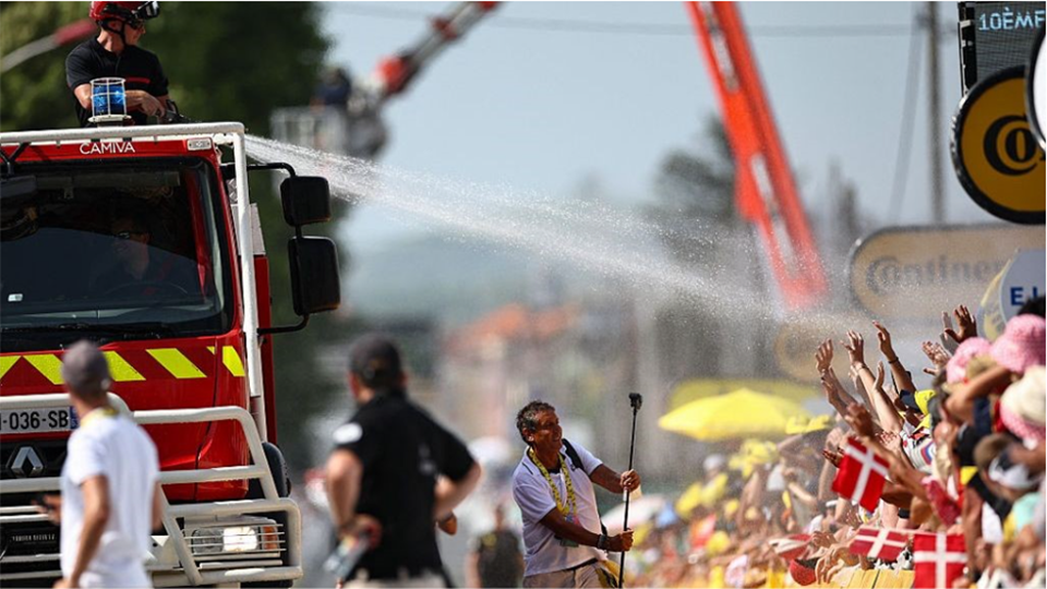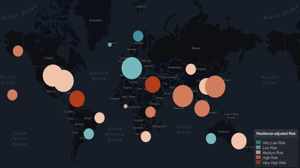
With extreme weather events becoming more frequent and severe, investors in real estate and infrastructure are increasingly focused on building climate resilience through targeted adaptation strategies. Broadly, we see these strategies falling into three main categories:
- Asset-level adaptations: such as elevating buildings or flood-proofing basements, typically undertaken by property owners
- Location-level adaptations: like levees, green infrastructure, or evacuation systems, usually delivered by governments
- Behavioral adaptations: including insurance uptake and emergency preparedness; in agriculture, this might mean shifting to drought-resistant crops or heat-tolerant livestock
Industry attention has focused heavily on asset-level adaptations, but we believe that investing in well-adapted locations also offers a powerful and often underappreciated path to resilience. This article explores the case for location-level adaptations, and how investors can screen target investment locations based on their adaptive capacity.
The Case for Investing in Adapted Locations
Local infrastructural adaptations and systems — such as stormwater management, fire warning notification, or wetland restoration — play an important role in reducing the physical impacts of climate hazards. But there is also mounting evidence that well-adapted locations outperform in real estate markets. Adaptation infrastructure (i.e., local infrastructural adaptations) not only lowers physical risk but also enhances buyer confidence, boosting asset value. In flood-prone areas such as Miami-Dade County, adaptation measures like floodwalls and sustainable drainage systems have increased property values by up to 10%, with a 2021 study estimating $300 million in aggregate benefits.
Data-driven investing in adapted locations
Identifying well-adapted, resilient locations requires more than intuition — it requires comprehensive data on local adaptive infrastructure and systems.
This is why AlphaGeo developed the Global Adaptation Layer, a unique geospatial dataset quantifying a location’s adaptation capacity for over 20 hazard-specific measures, from building strength to flood defenses.
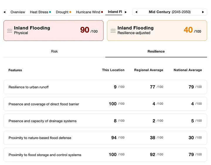
Figure 1 shows an example of that data for inland flooding (a full list of adaptaton datasets is in the Appendix).
Who is this data useful for?
- Asset owners and managers: Conduct due diligence or screen assets based on adaptation capacity, or develop asset adaptation strategies based on gaps identified
- Insurers: Strengthen climate risk models by integrating adaptation layers into exposure and vulnerability assessments
- Governments, non-profits, academia: Identify adaptation gaps, prioritize capital spending, and inform evidence-based resilience planning
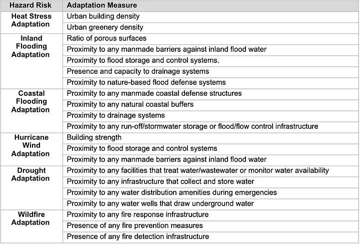
Appendix: AlphaGeo’s Global Adaptation Layer Datasets