Physical climate risk scores have proliferated across the institutional investment market. Flood maps, heat indices, wildfire probabilities — the data is increasingly granular and increasingly embedded in due diligence workflows.
But granularity on hazard exposure is only half the picture.
Climate risk is not simply a function of how severe a hazard may be. It is equally a function of how well a location, community, and asset are equipped to absorb and recover from that hazard. That capacity — adaptation — is where most risk models still fall short.
The problem with single-layer adaptation
Most physical climate risk platforms that account for adaptation stop at one of two extremes: broad societal indicators applied at a national or regional scale, or asset-level physical attributes assessed through a checklist.
Both capture something real, but neither is sufficient on their own. A high-income country with strong institutions does not guarantee flood-resilient neighborhoods. And a hardened building envelope offers limited protection when surrounding drainage infrastructure is inadequate, or emergency response capacity is thin.
Isolating any one layer produces a systematically incomplete picture — one that can lead to misallocation of capital, mispricing of risk, and adaptation strategies that address the wrong part of the problem.
AlphaGeo’s three-layer framework
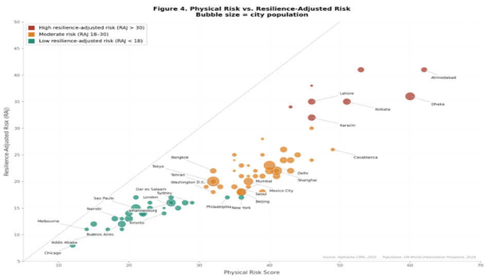
AlphaGeo’s Climate Risk & Resilience Index (CRRI) measures adaptation across three distinct levels. Together, they produce the offset coefficient applied to the physical hazard score to generate the Resilience-Adjusted Risk (RAJ) Score.
The Global Adaptation Layer is AlphaGeo’s most technically differentiated contribution. Using proprietary AI techniques for data extraction and spatial downscaling, it engineers globally consistent adaptation indices for each climate hazard at up to 30 meters resolution. Two assets with identical flood exposure scores can carry materially different RAJ Scores depending on the drainage and defense infrastructure surrounding them.
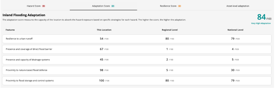
1. Location-level adaptation Proprietary hyperlocal geospatial datasets on hazard-specific physical infrastructure — drainage capacity, coastal defenses, fire response proximity, urban greenery — engineered at up to 30 meters resolution.
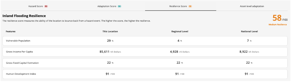
2. Societal resilience Fiscal, demographic, and institutional capacity — including local GNI and vulnerable population indicators — that determine a community’s ability to prepare for, respond to, and recover from climate hazards.
Societal resilience operates at the broadest scale, but its relevance to individual assets is direct. A municipality with limited fiscal capacity to maintain stormwater systems or fund post-event recovery is a material risk multiplier for every asset within its boundaries.
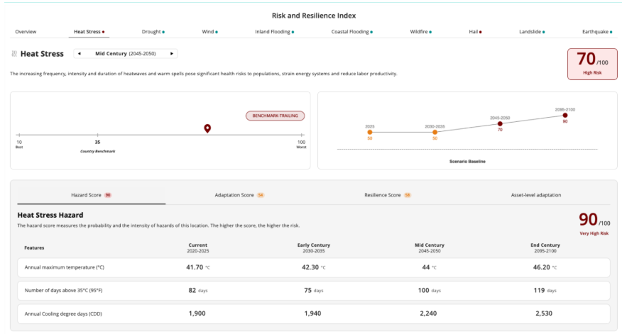
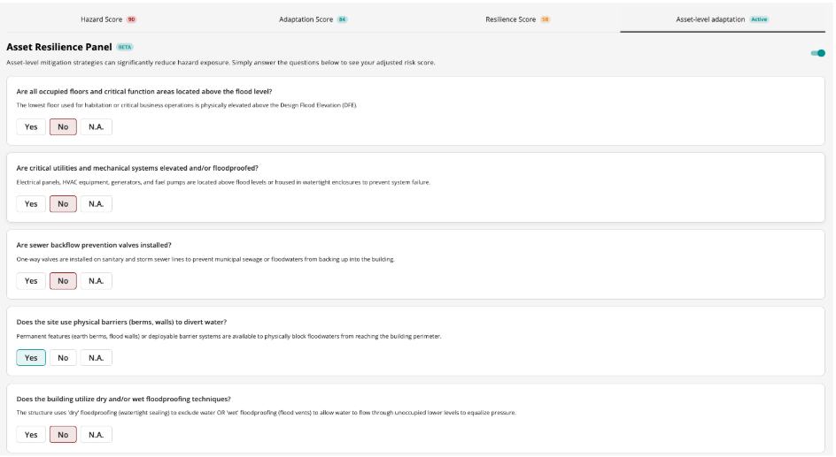
3. Asset-level resilience Physical attributes and adaptation strategies of the specific built asset, assessed via the Asset Resilience Panel — synthesizing over 100 strategies from more than 20 global engineering standards across 9 hazard types.
The Asset Resilience Panel draws on more than 20 global engineering standards — including FEMA, ASCE, REDi, IBHS FORTIFIED, LEED, and BREEAM — and applies a maximum 70% risk reduction cap, reflecting the principle that risk can never be fully eliminated. Critically, it is built on top of the CRRI’s location-based scores, not as a standalone alternative.
What this enables
The Adaptation Delta — the gap between the physical Risk Score and the RAJ Score — makes adaptation planning legible. A large Delta signals significant risk already absorbed by the surrounding environment. A small Delta points to locations where raw hazard exposure is largely unreduced, flagging a need for asset-level investment or a fundamentally different site selection decision.
Adaptation is not a checklist item. It is a multi-dimensional system, and a model that captures only one layer is, by definition, a partial model. AlphaGeo’s three-layer approach reflects how adaptation actually works — and produces risk intelligence that is both more defensible and decision-useful.
Start a free trial: app.alphageo.ai/trial_setup